Home » All posts
Krakatao volcano lies in the Sunda Strait and is an active underwater volcano phenomenal. On August 27, 1883 eruption of Mount Krakatao rocked the Sunda Strait, causing tsunami waves hit the coast of Lampung and Banten. Explosion that ejects the towering volcanic ash, spread to Europe. After the eruption, Mount Krakatao ancient sinkhole into the seabed. Gradually emerged a new crater called the children of Mount Krakatao, Mount Rakata.
Initially only a mound that pops up at sea level, but high volcano is now 315 meters. Vomit material from volcanic magma chamber makes it grow tall with an average rate of 4.5 centimeters a year. In the sea between the Rakata and Mount Krakatao's child appears bubbly sand dune.
Rakata island
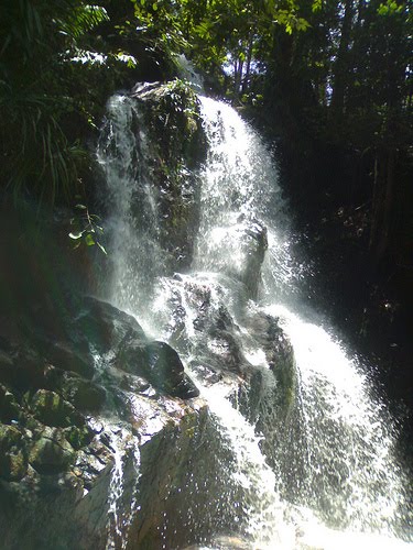
Guruh Gemurai Waterfall located in the District of Kuantan Mudik (Lubuk Jambi), precisely in the Village Kasang.
Guruh Gemurai is a name derived from the local language. Guruh is the sound of rumbling waterfalls. While Gemurai is the sound of splash water scattered. So construed Gemurai Guruh is a thunderous waterfall and have a splash.
On weekends and holidays, Object Tourism Waterfalls Guruh Gemurai crowded and become a mainstay of tourism object Kuansing District reliable.
Article By: Datuk Philosopher
Tanjung Bira is located in the southernmost end of South Sulawesi province, precisely in the District Bonto Bahari, Bulukumba about 40 km from City Bulu Kumba, or 200 km from Makassar City.
Tanjung Bira is famous for its white sand beaches are beautiful and fun. The water was clear, good for swimming and sunbathing. Here we can enjoy the sunrise and sunset with a light shining on the white sand along tens of kilometers.
Tanjung Bira Beach very beautiful and stunning with white sand as soft as flour. On location, visitors can swim, sunbathing, diving and snorkeling. The visitors also can watch the sunrise and sunset in the same position, and can enjoy the beauty of two islands in front of this beach, which Liukang Island and Goat Island.
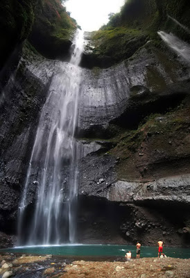
Its location not far from the sea of sand Bromo, only about 45 minutes toward Probolinggo (north). His name is Madakaripura waterfall. According to locals this name is taken from a story in the days of old, reputedly "Patih Gajah Mada" spend rest of his life by meditating on this waterfall. This story is supported by the statues of Gajah Mada in the parking lot area.
To reach this resort is not too difficult. Should visits be done if we are going to Bromo in Probolinggo direction because the direction of travel or while in Bromo and performed in the morning.
For you fans of photography, this location could be the object of endless, ranging from the entrance of the arrival until the atmosphere is like a waterfall in the tube.
 |
| Waterfall Madakaripura |
But the lack of information about this place and the security guarantees that are not yet resulted in very few people know and want to visit this tourist area. With enough promotion, visitors will be able to add to a list Bromo tourist destination.
Indonesia's surfers paradise! Looks like the surfers of this opinion can be proved by many a beach destination that offers great waves for surfing.
Your hobby surfing, Gerupuk Beach suitable for your holiday while your surfing hobby, because this beach is a paradise for surfers.
Panoramic beaches and the exotic nature in this tropical paradise lies in Indonesia is Gerupuk beach located on the beach and bay areas of Central Lombok regency in West Nusa Tenggara Province.
Gerupuk beach is a beach on the east of Kuta beach, Lombok. This beach has a natural landscape that is not less interesting to the famous beaches in Indonesia.
The beach is a roll of the waves for surfing enthusiasts pamper its domestic and foreign tourists. This may be somewhat unique beach for surfers as it has 5 levels of difficulty to surf, to surf each spot on the coast certainly is not difficult. We will be guided by an experienced guide to using the boat.
The advantages of this beach is the surfer can be enjoyed from all classes. The beach is at the top into two parts for the surfers, the onshore for new surfers to learn, while offshore for senior surfers.
For those who are beginners, are encouraged to come to the Turtle Point. It is commonly used spot for tourists who are just learning to surf.
At first it's hard to be standing on a surfboard. However, it can be exciting sensation you get when you can conquer the waves. Are guaranteed, you'll be hooked and want to repeat it several times.
Called Gerupuk Beach as located in Gerupuk village, just 9 km from Kuta. Locals livelihood as fishermen, seaweed cultivation, and raising the catch using a bagang apung and keramba. Gerupuk Beach is very famous as a place to surf even the best, because the waves are always great throughout the season.
At first it's hard to be standing on a surfboard. However, it can be exciting sensation you get when you can conquer the waves. Are guaranteed, you'll be hooked and want to repeat it several times
Visit the City of Kokas, Fakfak, West Papua, was not complete if you miss the opportunity through the remains of World War II contained in this town.
in the period 1942/1945, Kokas had the title as the base city of the Japanese army's defense against the allies.
As a military fortress, Kokas would save many relics. One witness the most historic relics such events is building a cave or a castle located in the central Japanese city of Kokas.
 |
| Red hand stamp on the walls in coke |
However, herein lies precisely sensation down the cave is located. Curiosity will not be answered immediately as you enter the cave. In light-minus, you still have to feel and look for 'surprises' in every corner of the cave that passes. It is too dear to miss any detail of luxury corridor in the cave. You will find that many rooms are partitioned like a bedroom.
Satisfied enjoy penyusuran, you can unwind by enjoying the beauty of the scenery of sea and headland in front of the cave. The vast panorama that stretches you can see from the top of a hill.
South Bukit Barisan National Park is representative of the Bukit Barisan mountain range consisting of vegetation types of mangrove forest, beach forest, tropical forest pamah up to the mountains in Sumatra.
South Bukit Barisan National Park stretches from north of Bengkulu province, following the back of the Bukit Barisan mountain range extends to the south, to the Cape of China-Carambola on the southern tip of Lampung province.
Change and development of a National Park Wildlife Sanctuary is nothing but the manifestation of conservation efforts to protect and conserve natural resources contained therein. South Bukit Barisan National Park presents a challenge to the visitors to enjoy the wealth and natural beauty.
Because of the influence of the Bukit Barisan Mountains, this park is divided into two distinct areas, where half of the eastern semi-arid region. However, the relatively high rainfall throughout the year across the region.
Regions South Bukit Barisan National Park backed the southern tip of the Bukit Barisan Mountains, which has a fairly rugged topography. Quite steep eastern slopes, while the western slopes, towards the Indonesian Ocean, slightly sloping. The highest peak of this national park is Mount Pulung (1964 m asl) located on the west side of Lake Ranau. In addition, there are still many other mountains, namely: G. Sekincau, G. Balirang, and Bukit Pandan Bukit Gedang.


