Home » All posts
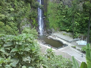
Sipiso-piso Waterfall fantastic, located in the village of Tongging. enjoying the beautiful scenery as tourist areas in the village of Tao Silalahi that are nearby. Tanah Karo beautiful scenery from the hilltop, the starting point flow Sipiso-piso waterfall. From the top of the hill surrounding the Sipiso-piso Waterfall is also able to witness the beauty of the landscape of Lake Toba, the largest volcanic lake in the world.
Sipiso-piso Waterfall is a natural tourism area which is located not far from the village community settlements Tongging. Tongging village on the plains is lower, while Sipiso-piso Waterfall located in the hills higher than Tongging Village. The waterfall is located at an altitude of approximately 800 meters above sea level (asl) and is surrounded by green hills covered with pine forests since.
Sipiso-piso meaning comes from the blade. Swift water-water that fell from the hill above the hundred-meter altitude is likened like-bladed sharp knife. In addition, a steep cliff when viewed from the top of the hill make a local call
See the charm of natural beauty Sipiso-piso up close, you need along the ridge through the hundreds of small steps that have been provided for the down and approached the waterfall. Line of stairs that had been prepared it is a major road safety. At the bottom, looking toward the small hills accompanied by the roar splash billions of water droplets that bounce from the point of falling water. This waterfall has a height of 120 meters or about 360 feet before flowing into Lake Toba, splashing waterfall is larger than the Sigura-Gura Waterfall famous natural tourist area in North Sumatra.
Sipiso-piso waterfall located in the District Brand, Karo District, North Sumatra, Indonesia. Sub-district is located about 24 km from the city Kabanjahe, the capital of Karo Regency.
Kerinci Seblat National Park is located in 4 regions of the province of West Sumatra, Jambi, Bengkulu and South Sumatra. Most of the park is the South Bukit Barisan mountain range in central Sumatra island.
 |
| the National Park Kerinci Seblat |
In the history of its formation, this national park is the union of regions Inderapura Nature Reserve and Bukit Tapan, Wildlife Rawasa Huku Lakitan-Bukit Kayu dew and Gedang Seblat, protection forest and limited production forests surrounding the hydro-orologis functions which are vital to surrounding area.
Forest National Park, Kerinci Seblat has 4000 species of plants that is dominated by the family Dipterocarpaceae, with rare and endemic flora of the Kerinci pine (Pinus merkusii strain Kerinci), wood bloodsucker (Harpulia alborera), Rafflesia flower (Rafflesia arnoldi) and the carrion flower (Amorphophallus titanium and A. decussilvae).
Not less than 4000 types of flora (63 families) in areas dominated by the family Dipterocarpaceae, Leguminosae, Lauraceae, Myrtaceae, Bommacaceae, Moraceae, Anacardiaceae, Myristicaceae, Euphorbiaceae and Meliaceae. While at an altitude of 500 m - 2000 m above sea level. dominated by the families Fagaceae, Erycaceae and sub-alpine shrubs of Vaccinium and Rhododendron type.
Some typical types of vegetation in the Kerinci Seblat National Park, among others: Histiopteris insica (highest vascular plants) are on the wall of the crater of Mount Kerinci, various types of Nepenthes sp, Pinus mercusii strain Kerinci, Wood bloodsucker (Harpullia arborea), Flower Raflesia (Rafflesia arnoldi) , Agathis sp.
Mount Wilis is a non-active mountain located on the island of Java, East Java Province, Indonesia. Mount Wilis was originally named the mountain Pawinihan. Mount Wilis has a height of 2552 meters. The peak at the border between the six districts of Kediri, Tulungagung, Nganjuk, Madiun, Ponorogo, and Trenggalek.
 |
| Mount Wilis - East Java |
Mount Wilis also has a panoramic view of nature that is not less amazing for you who like the panorama of the falls, be prepared to awe. Imagine, several waterfalls with stunning panoramic view all around, can be found on the east side of Mount Wilis this.
If we hear the waterfall tour is located in the village sedudo Ngliman, Sawahan District, East Java. this waterfall has many benefits, one of which is to be the drug of youth. It is widely believed to surrounding communities, as well as people outside Nganjuk. Evidently if this waterfall tour never deserted from the visitors. Well that just want to enjoy its beautiful scenery, or are deliberately trying to prove the myth that many developing itu.Namun no one knows what causes a waterfall located in the southern Nganjuk have myths like this. Assess the history, myth is based on the formation history of the waterfall and scientific study.
Altitude location of Waterfall sedudo attraction around 1438 meters above sea level, so cool air and the weather was, of course. While the waterfall itself was not too high, only about 100 meters.
Traditionally, people around the Waterfall sedudo still have a mystical belief and Waterfall sedudo much visited during the month of Suro to bathe in the waterfall to get the blessings of youth.
This tourist attraction not only offers beautiful scenery and the cool splash of water. But also the traditional rituals at the full moon. From a ritual that is experienced as the source of the river of life.
Situated in a panoramic area of Mount Wilis beautiful and cool air, sights sedudo waterfall can be selected as a pleasant tourist destination. Although there is only a waterfall, but visitors will soon find out, a waterfall that provides economically blessing and bring prosperity to the surrounding community. At least the water that flows from the waterfall is capable of providing adequate water supply throughout the year for hundreds of hectares of rice fields and gardens.
The atmosphere is quiet, cool and comfortable and the green expanse of natural trees, the waterfall looks like a royal princess sedudo standing majestically in the middle of the park beautiful nan. So anyone, it feels like to walk over to enjoy the beauty and linger sitting nearby.
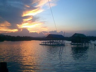
Bontang Kuala is one of the resorts in Bontang, East Kalimantan. Bontang Kuala located at the east end of Bontang and dealing directly with the Makassar Strait.
There would be a complete visit Bontang, if not yet set foot in one of the culinary tourism and the community, Bontang Kuala. Icon City Park is located in the southern city of Bontang it is a residential area directly adjacent to the Sea region.
 |
| Resorts in Bontang Kuala - East Kalimantan |
No wonder if every dusk, two-wheeled vehicles crowded the walkways Bontang Kuala settlement. They throng rushing toward the area of culinary tourism. The majority of houses and paths in Bontang Kuala typically made of wood called the Wood Ulin Kalimantan.
In restaurants and cafes are located on the shoreline and the sea water above it, guests will be pampered her with open landscapes and the breeze from the sea. For those who want to enjoy the beauty of Sunset. while enjoying the cuisine and beverages, Bontang Kuala is a very precise location. If you want to feel the pulse of the sea lane Longer life, local residents can prepare accommodation for tourists who want to stay.
Bontang Kuala residential areas there are a number of rituals are routinely held at Bontang Kuala coast. One of the mass activities of local residents is the Feast of the Sea are generally held every summer. Sea party that was held for about a week's diverse attractions featuring the art of dance. On that occasion, a number of historic items such as kris, spears and found an old jar of local residents are also showcased.
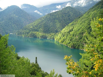
Lake Napabale very beautiful and tranquil, situated near the sea coast, salt water and connected by a tunnel cross section was 16 square meters with high seas. A tunnel with a cross section of 16 square meters which connects the bowl porcelain and crystal clear turquoise water with the open sea. Chunks of rock covered with green trees sticking out at the water's surface, circling around the lake is salt water. In clear water and cool it, visitors can swim satisfying hobby. If the tourists happy boating, boat builders are ready to take tourists around the lake to enjoy the panorama around the lake, then to the beach through the tunnel coral seas.
 |
| lake napabale - Southeast Sulawesi |
Napabale lake salt water lake located in the foothills of the Village Lohia, Muna, Southeast Sulawesi.
Some small coral islands stand in the middle of the lake with graceful like a saucer on top, turquoise-colored water. The bottom of the atoll is the result of geomorphological processes magic for thousands of years on the island of Muna mostly chalky soil.
Number of lake water discharge is highly dependent on the ebb and flow of sea water. If the tides, the surface of the lake go up and connecting tunnels will be covered by water. However, if the low tide, then the reduced part of the lake water. The tunnel is also often used by fishermen as a path when it will depart or return from fishing.
Visiting Lake Napabale, tourists can enjoy two charm as well as natural attractions, the lakes and beaches. The beauty of the lake can be enjoyed while yachting on a boat or by diving under the water while watching the amazing scenery (snorkeling). Were it not be paddling the canoe alone, tourists can ask for help on fishermen to take with samapan until the middle of the lake, where there is a coral island is verdant wooded.
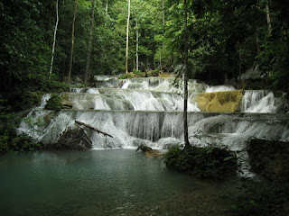
Cool, calm and wonderful, that's the first impression in the region this waterfall. From an altitude of 100 meters waterfall flowing Moramo seven main levels so that the category of multilevel waterfall (cascade) which was lovely. In addition to the seven main levels, there are also 60 small level that looks like a small pool of water that flows resting place is. and at the last level is the perfect place to take a bath with bath. while natural inhabitants of this habitat is diverse birds, butterflies, colorful, and various other animals. breezy sound that lacks the beauty of waterfalls, chirping birds who shouted and dance combined with colorful butterfly colorful.
 |
| Waterfall Moramo - South Sulawesi |
Water Falls Nature Reserve Area is located Moramo Peropa Konawe Cape South, Southeast Sulawesi, or rather in the village of Sari Resources, District Moramo.
Towards the first level through the rocks that rise as will the stairs covered with carpet that is very clear water. we can see the most amazing natural charm that is when sun rays reflected from the stones emit a rainbow of colors dominated kehiajau bluish light, and as if dancing collide froth flowing water.
In the area of this waterfall, there is a potential wealth of natural stone in the form of a very large marble and is one of the sources of the world's largest marble reserves.
In addition to the seven main levels, there are also 60 small form that functions as the shelter of water (like pool). Among the many pools, the one that is often used for swimming. Clear water, cool and comfortable making visitors feel sights of this visit is incomplete if it did not go and swim in the pond.
Complete is the beauty of the mighty works of nature in tourism Moramo Waterfall. Scenery, the sound of waterfalls, chirping birds who shouted, combined with the dance of colorful butterflies.
Waterfall Curup Calm is the highest waterfall (99 m) in South Sumatra are located in the Village Bedegung, Cape District Court, about 56 miles south of Muara Enim regency in South Sumatra Province.
 |
| Waterfall Curup tenang - South Sumatra |
This waterfall comes from springs that never dry in the gap Bukit Barisan and downward to form a small river rapids and rocky.
This natural waterfall is a place of recreation that provides coolness to visitors because of gusts of wind that carries water droplets. Natural atmosphere surrounding mountains are truly impressive.


